
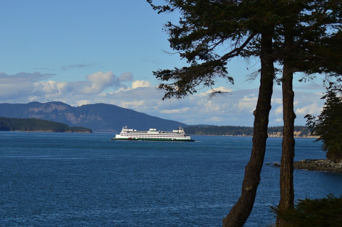
Most transportation systems exist to shorten the distance between places.
The Washington State Ferries network does something more. It makes a landscape of water traversable, connecting islands, peninsulas, and coastal communities into a region that functions as a whole.
Stretching across Puget Sound and the inland waters of northwestern Washington, the system links communities that geography has kept apart for thousands of years. In a region defined by bays, channels, and islands, ferries are not simply an alternative to bridges. They are an integral part of how the landscape is experienced and how people move through it.
The largest ferry system in the United States, the network serves commuters, commercial traffic, visitors, and island residents alike. On any given day, its vessels carry thousands of passengers and vehicles between terminals that have become familiar landmarks in their own right. While individual routes vary in length and purpose, together they form a connected web that quietly shapes life throughout the region.
A Landscape Shaped by Water
That network exists because of geography.
Puget Sound is a remarkably complex body of water. Long fingers of saltwater extend inland from the Pacific, creating natural barriers between communities that may be only a few miles apart as the crow flies. Islands large and small, deep fjord-like inlets, and broad channels interrupt what might otherwise have become a continuous road network.
Rather than attempting to bridge every crossing, Washington developed a system that works with the landscape instead of against it. Ferries became moving links in the transportation network, extending highways across the water and allowing communities to remain connected without fundamentally altering the geography that defines the region.
Instead of viewing Puget Sound as a single body of water, it is more useful to think of it as a network of waterways. Narrow passages widen into broad basins before giving way to sheltered bays, long inlets, and island channels that divide the landscape into countless peninsulas and shorelines. Communities that appear close together on a map are often separated by water that requires a lengthy drive around its edge.
In many parts of the world, geography eventually gives way to engineering. Rivers are bridged, valleys are filled, and coastlines become continuous corridors of highways. Puget Sound tells a different story. Its scale and complexity have encouraged a transportation system that works alongside the landscape rather than attempting to erase it.
The result is a region where roads do not always provide the most direct connection between places. Instead, highways frequently arrive at the water’s edge, pause, and continue only after a crossing. The ferry is not a detour from the road. In many cases, it is the road.
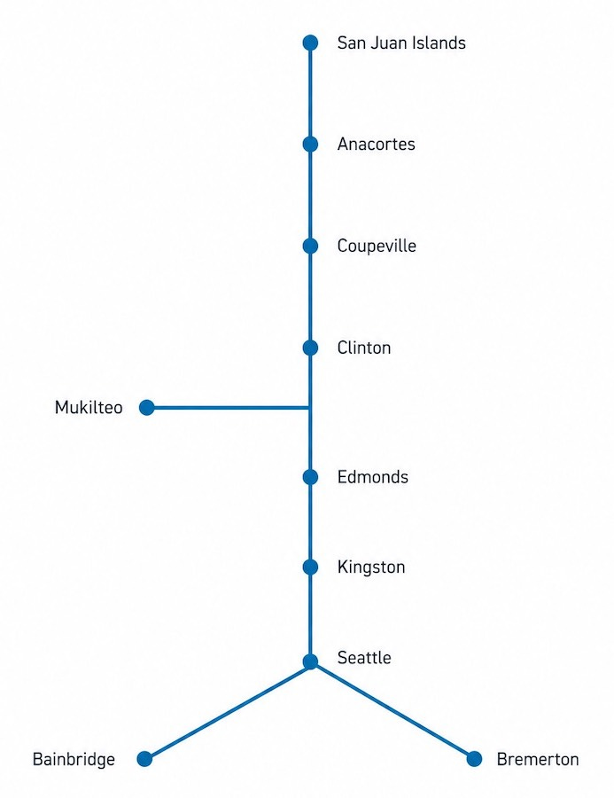
Seen together, the principal crossings reveal a network whose structure is shaped as much by geography as by transportation needs.
Connection Diagram
Simplified overview of several principal connections within the Washington State Ferries network.
Route Snapshot
Route Type
Regional Ferry Network
Role
Connecting communities across Puget Sound
Region
Puget Sound, Washington
Primary Connection
Mainland, island, and peninsula communities
Operator
Washington State Ferries
Established
1951
Scale
Largest ferry system in the United States
Notable For
Integrating ferry crossings into Washington's state highway system
From Waterways to a Regional Network
Many of today’s routes trace patterns of movement that long predate the ferry system itself. Indigenous peoples traveled these waters for generations by canoe, establishing connections among coastal villages and islands long before modern infrastructure arrived. Later, commercial steamships carried passengers, freight, and mail throughout Puget Sound, helping establish many of the communities that continue to rely on water transportation today. The modern ferry system grew from these earlier networks, gradually evolving into a unified public service that connects much of western Washington.
As roads improved throughout the twentieth century, many ferry crossings elsewhere disappeared, replaced by bridges or longer highway routes. Around Puget Sound, however, the geography continued to favor water crossings. Rather than becoming obsolete, the ferries became increasingly integrated into the state’s transportation system.
Individual routes that once operated independently gradually came to function as parts of a coordinated network. Timetables, terminals, vessels, and highways evolved together, allowing travelers to move across water with much the same expectation of continuity that they experience on land. A crossing was no longer an isolated journey between two shores but one link within a larger system of regional movement.
That integration shaped more than transportation. Communities grew with the understanding that reliable ferry service connected them to employment, education, commerce, and neighboring towns. The network became part of the region’s everyday infrastructure, quietly influencing where people lived, how businesses operated, and how islands and peninsulas remained connected without losing the distinct geography that defined them.
A System of Connections
Each route within the Washington State Ferries system reflects a different relationship between geography and movement. Some function as major commuter corridors, carrying thousands of passengers between population centers each day. Others provide the only practical connection for island communities whose daily rhythms rely on dependable crossings. Still others serve regions where water offers a more direct path than roads circling the shoreline.
The Seattle–Bainbridge route, for example, links the urban waterfront with the Kitsap Peninsula, serving commuters, residents, and visitors alike. The Mukilteo–Clinton crossing provides an essential connection between the mainland and Whidbey Island, forming part of everyday travel for work, school, and commerce. Farther north, the Anacortes terminal extends the network into the San Juan Islands, where ferries connect multiple island communities that cannot be linked by bridges.
Although each crossing has its own character and purpose, they are not isolated services. They depend upon one another as parts of a regional transportation network whose effectiveness comes from the relationships between its routes. The system is best understood not as a collection of ferries, but as a woven framework of connections that allows movement across a landscape where water is as significant as land.
Viewed on a map, those relationships become especially clear. Lines stretch across bays and channels much as highways branch across valleys, revealing patterns of movement that are shaped less by political boundaries than by geography itself. The network does not simply connect destinations; it reflects the structure of the region.
A Different Kind of Road
For travelers, a ferry crossing introduces a rhythm that differs from almost any other form of road travel. Highways encourage continuous motion, measuring progress through speed and distance. Ferries ask travelers to pause. Vehicles gather at the terminal, departures follow a schedule rather than a traffic signal, and the crossing unfolds at the pace of the vessel and the water.
That pause changes the experience of movement. During the crossing, the shoreline becomes something to observe rather than simply pass. Headlands, islands, working harbors, and distant mountain ranges gradually shift into view as the vessel moves between them. The transition from one shore to another becomes visible in a way that a bridge or tunnel rarely allows.
Yet the crossing never loses sight of its practical purpose. These vessels exist to connect communities efficiently across water, not to provide sightseeing excursions. Their distinctive atmosphere emerges precisely because they remain ordinary. For the commuter, the crossing is part of the workday. For the island resident, it is part of everyday life. For the visitor, it offers a brief glimpse into a transportation system that has become inseparable from the landscape it serves.
Connections Woven into the Landscape
Perhaps that is what makes the network so compelling.
It demonstrates that infrastructure can become part of a region’s identity without trying to be a landmark in its own right. The ferries are neither hidden nor celebrated as monuments. Instead, they have become familiar companions to everyday life, quietly connecting places that might otherwise feel isolated from one another.
The Washington State Ferries network reminds us that travel is shaped not only by where we are going, but also by the connections that make those journeys possible. Between the shores of Puget Sound, those connections are not incidental. They are woven into the landscape itself.
Continue the Journey
Next Route
The San Juan Island Ferry Crossings
A closer look at the island routes that extend the Washington State Ferries network beyond Anacortes.
Woven Routes Editorial
Part of the Renascent Works Travel Collection, exploring the routes, crossings, and connections that shape how we travel.