
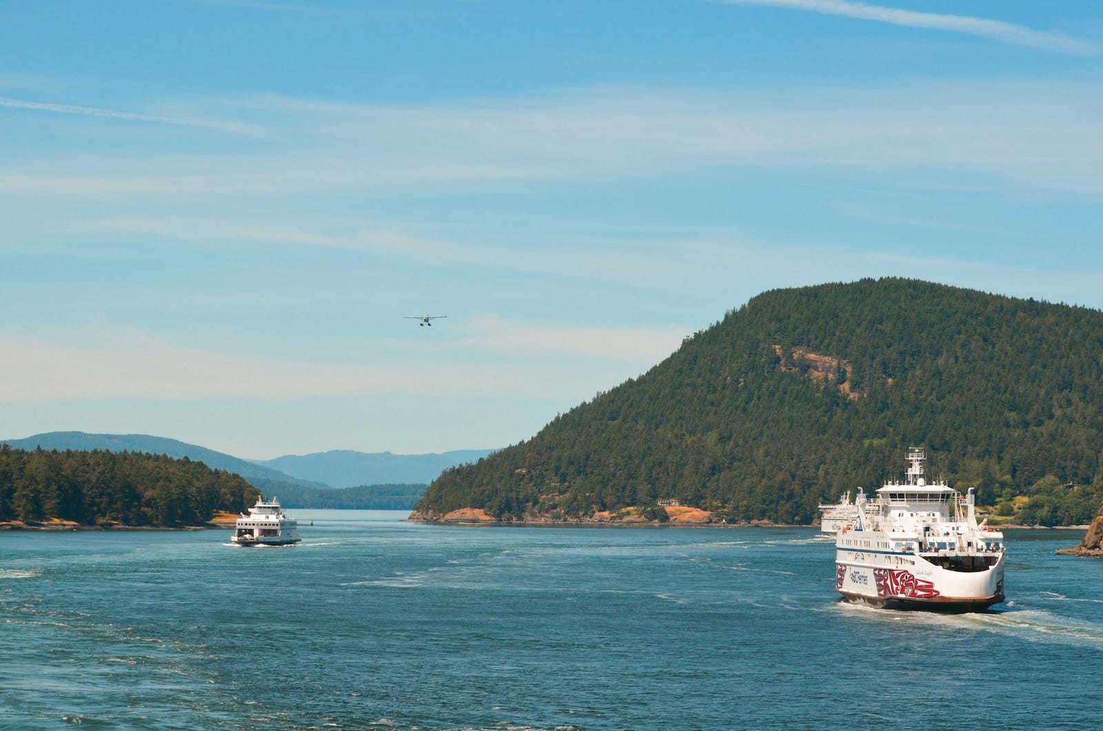
The San Juan Islands appear on a map as scattered pieces of land separated by channels, sounds, and tidal passages. Yet for residents, businesses, and visitors alike, these waterways are not simply barriers. They are the spaces crossed every day by a coordinated network of ferry routes that turns dozens of individual islands into an interconnected region.
While the broader Washington State Ferries network links metropolitan communities around Puget Sound, the San Juan ferry crossings serve a different purpose. Here, each sailing becomes one part of a larger sequence of connections, carrying passengers, vehicles, freight, and essential services between mainland Washington and the islands that depend upon these routes throughout the year.
Rather than existing as isolated ferry trips, the crossings function together as a transportation system shaped by geography itself.
Geography
The San Juan Archipelago lies between the Washington mainland and Vancouver Island, occupying a landscape defined by narrow channels, sheltered passages, and hundreds of islands ranging from large inhabited communities to small rocky islets.
Unlike many coastal regions where bridges gradually replace water crossings, the geography here makes permanent roadway connections impractical. Deep channels, strong currents, protected marine habitats, and the sheer number of islands have preserved water transportation as the region’s primary means of connection.
Most travelers begin their journey at the mainland terminal in Anacortes. From there, the ferry system extends outward through the islands in a branching pattern, with vessels serving several destinations during a single voyage depending on the sailing schedule.
The result is not simply transportation across water, but a carefully coordinated extension of Washington’s highway system into an island landscape where roads continue only after each crossing is complete.
Connection Diagram
Washington Highway System
↓
Anacortes
↓
Island Ferry Crossings
├ Rosario Strait
├ Upright Channel
├ President Channel
└ San Juan Channel
↓
Lopez • Shaw • Orcas • San Juan
Editorial diagram illustrating the principal crossings that connect the mainland with the inhabited San Juan Islands.
Route Snapshot
Route Type
Ferry Crossing
Role
Connecting mainland Washington with the inhabited San Juan Islands
Region
Salish Sea, northwestern Washington
Primary Connection
Anacortes ↔ Lopez, Shaw, Orcas, and San Juan Islands
Operator
Washington State Ferries
Established
Modern state operation since 1951 (building on earlier private ferry services)
Scale
Four principal island terminals served from a common mainland gateway
Notable For
A coordinated multi-stop island transportation system rather than independent point-to-point crossings
Crossing Profile
Barrier
The waterways of the Salish Sea
Connector
Washington State Ferries
Movement Pattern
Scheduled crossings linking multiple island communities
Travel Rhythm
Alternating road and water segments
Relationship to Geography
Works with the islands and channels rather than replacing them
What Makes It Distinctive
A continuous transportation system where the route changes form instead of remaining on pavement
History
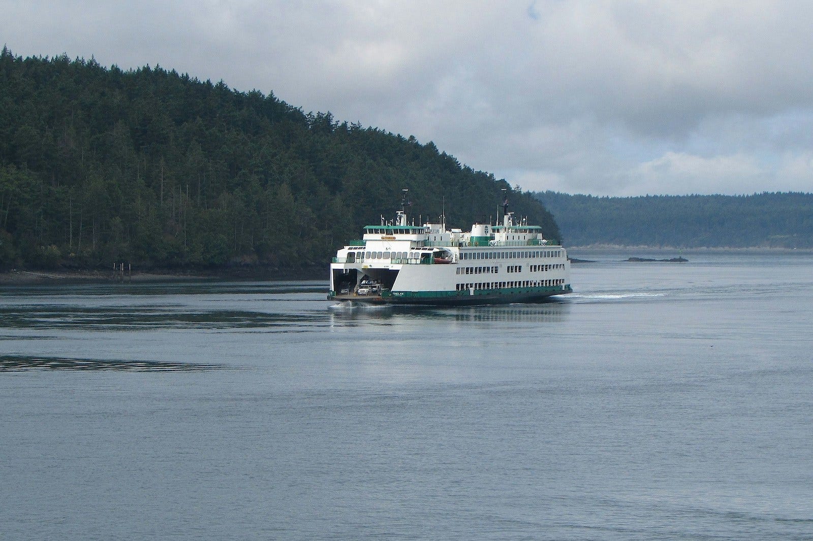
Long before automobiles reached the islands, travel across the San Juan Archipelago depended upon boats carrying people, supplies, livestock, and mail between isolated communities.
During the early twentieth century, numerous private ferry operators provided these connections, though schedules varied and service was often shaped by seasonal demand or commercial priorities. As automobile ownership increased and dependable transportation became more important for island communities, Washington gradually assumed responsibility for many ferry routes throughout Puget Sound.
The San Juan crossings became part of this broader transition when the state expanded and unified its ferry operations during the mid-twentieth century. What had once been separate local services evolved into a coordinated public transportation system that could reliably connect island residents with schools, healthcare, commerce, and government services on the mainland.
Today, despite advances in bridge engineering elsewhere, the fundamental role of these crossings remains remarkably similar: providing continuity across waterways where no permanent road exists.
The Crossings as a Connected System
Although travelers often think of individual destinations such as Friday Harbor or Orcas Island, the ferry operation functions less like separate routes and more like an integrated circulation system.
Many sailings serve multiple islands during a single voyage. A vessel departing Anacortes may stop at Lopez Island before continuing to Shaw Island and Orcas Island, while other sailings prioritize San Juan Island or follow different operational patterns based on demand and seasonal schedules.
This flexibility allows the network to balance the differing needs of several island communities while making efficient use of vessels and crews.
Each terminal becomes both a destination and a transfer point within the wider system. Roads on one island lead naturally toward the next scheduled sailing rather than toward a bridge or highway interchange. In this way, the ferry itself becomes another segment of the regional transportation network.
The crossings also support far more than tourism. Residents commute to work, students travel to schools, commercial vehicles transport goods, emergency services rely upon dependable access, and local businesses depend upon predictable movement between islands and the mainland.
Seen together, the routes form the connective framework that allows separate island communities to function collectively while maintaining their individual identities.
A Different Rhythm of Travel
Travel through the San Juan crossings unfolds at a pace shaped by the ferry schedule rather than uninterrupted highway driving.
Vehicles assemble at terminals well before departure, passengers step onto open decks as vessels leave the dock, and familiar landmarks gradually give way to wooded shorelines, rocky passages, and neighboring islands emerging on the horizon.
Unlike a bridge, which compresses a crossing into a brief transition, the ferry creates an interval between places. That interval encourages awareness of the surrounding waterways and reinforces the understanding that each island remains connected by deliberate movement rather than continuous pavement.
For island residents, this rhythm becomes an ordinary part of daily life. For visitors, it often becomes one of the defining characteristics of traveling through the archipelago.
The San Juan crossings remind us that a transportation network does not always alter geography. Sometimes its greatest achievement is learning how to move with it.
Instead of replacing the waterways that separate the islands, the crossings work with them, extending Washington’s road network across open water through a coordinated series of dependable connections.
Viewed individually, each sailing links one community to another. Viewed collectively, they reveal something larger: a transportation system that transforms an archipelago into a connected region while preserving the character of the landscape that makes it unique.
Continue the Journey
Previously in Woven Routes
The Washington State Ferries Network explores the larger system that connects communities throughout Puget Sound, placing the San Juan crossings within the broader transportation network that serves western Washington.
Next Route
Going-to-the-Sun Road examines how a single mountain road threads across the Continental Divide, revealing how engineering and landscape combine to create one of North America’s most distinctive travel corridors.
Explore the Region
The ferry crossings provide the connective framework of the San Juan Islands. To better understand the islands themselves—including where to stay, how the communities differ, and how to experience the archipelago at a slower pace—see A Thoughtful Guide to the San Juan Islands from Hearthline.
Woven Routes Editorial
Part of the Renascent Works Travel Collection, exploring the routes, crossings, and connections that shape how we travel.