
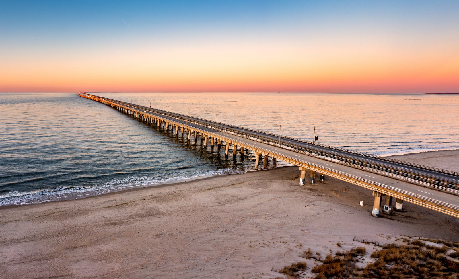
At the southern end of Virginia’s Eastern Shore, U.S. Route 13 runs out of land.
Ahead lies the mouth of Chesapeake Bay, where the protected waters of one of North America’s great estuaries meet the Atlantic Ocean. On the other side are Virginia Beach and the cities of Hampton Roads.
Since 1964, the highway has continued across.
The Chesapeake Bay Bridge–Tunnel carries U.S. 13 for 17.6 miles from shore to shore, using a sequence of low bridges, artificial islands, tunnels, and higher spans to create a continuous highway across open water.
Its unusual form is what makes the crossing worth understanding.
Most bridges solve the problem of water by rising above it. The Chesapeake Bay Bridge–Tunnel sometimes does the opposite. As the highway approaches major navigation channels, it descends toward an artificial island and disappears beneath the water before emerging again on the other side.
The reason is not simply engineering ambition.
Ships also need to cross this route.
The entrance to Chesapeake Bay is an important maritime passage, connecting ports around Hampton Roads and farther up the bay with the Atlantic. It also provides access between the Atlantic and the major U.S. naval presence around Hampton Roads.
That made keeping the principal shipping channels open especially important. At Thimble Shoal Channel, the Navy opposed a conventional bridge that could create an obstruction to naval access if the structure were damaged or destroyed. Sending the highway beneath the channel avoided placing that potential barrier above it.
A highway across the mouth of the bay therefore had to accommodate two very different kinds of movement: vehicles traveling north and south and ships traveling east and west.
The Chesapeake Bay Bridge–Tunnel is a crossing designed around another crossing.
A geographic gap
Virginia’s Eastern Shore occupies the southern end of the Delmarva Peninsula, a long strip of land between Chesapeake Bay and the Atlantic Ocean.
U.S. 13 follows the peninsula south through Delaware, Maryland, and Virginia. But near its southern end, the land narrows and then stops.
Across the water lies the rest of coastal Virginia.
For much of the region’s history, that separation made water transportation essential. Packet ships and steamers connected communities across the lower bay, and automobile ferries eventually carried vehicles between the Eastern Shore and Hampton Roads.
By the 1950s, a seven-vessel fleet was making as many as 90 one-way crossings a day.
The ferry connected the two shores, but it also reflected the limitations imposed by the geography. Drivers arrived at the water, left the highway system, boarded a vessel, crossed the bay, and returned to the road on the other side.
As automobile traffic increased, Virginia began considering a fixed crossing.
Building one would require more than spanning the water.
The route also had to leave the entrance to Chesapeake Bay open.
Across the water
The Chesapeake Bay Bridge–Tunnel is best understood not as a single bridge but as a sequence of different structures.
CONNECTION DIAGRAM
Virginia’s Eastern Shore
U.S. 13 south through the Delmarva Peninsula
↓
Fisherman Inlet Bridge
↓
Fisherman Island
↓
North Channel Bridge + low trestles
↓
Chesapeake Channel Tunnel
under a major shipping channel
↓
Low trestles
↓
Thimble Shoal Tunnel
under a major shipping channel
↓
Low trestles across Chesapeake Bay
↓
Virginia Beach / Hampton Roads
Leaving the Eastern Shore, U.S. 13 moves onto the structures carrying it across the mouth of the bay. The roadway remains relatively close to the water, with the horizon often more prominent than the land behind or ahead.
Then the route begins to descend.
At major navigation channels, the highway reaches artificial islands built into the bay. From these islands, the roadway enters tunnels beneath the shipping channels before climbing back toward the surface.
The pattern repeats as the route continues.
Elsewhere, bridges carry the highway above other channels, and near the Eastern Shore the road passes across Fisherman Island, a natural barrier island at the mouth of the bay.
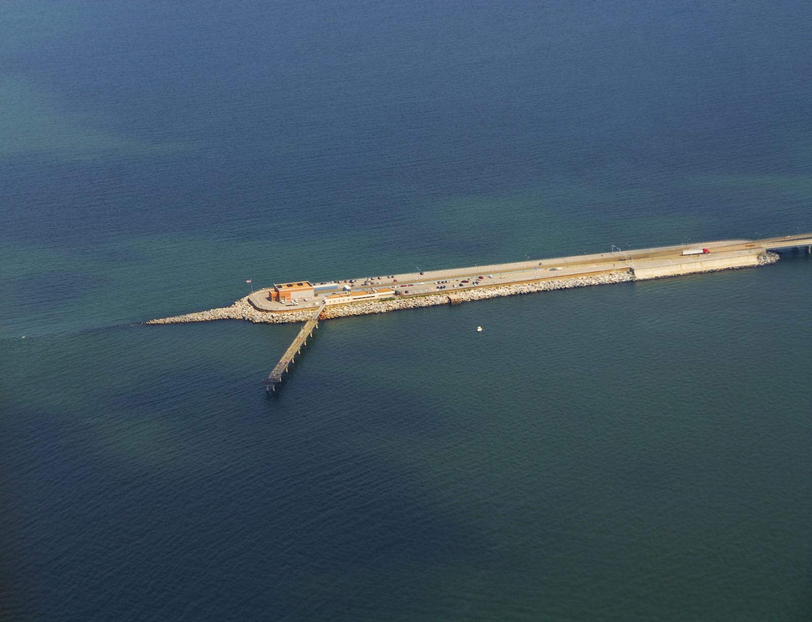
The result is a crossing that continually changes its relationship with the water.
The sequence can initially seem unnecessarily complicated.
Geography explains it.
A conventional high bridge could carry vehicles above a shipping channel, but it would introduce a permanent overhead structure into the maritime approach to Chesapeake Bay. The tunnels instead allow major vessels to pass through the channels without a bridge directly above them.
Rather than requiring maritime traffic to accommodate the highway, portions of the highway move underneath maritime traffic.
Beneath the shipping lanes
The original tunnels were not bored through the earth beneath Chesapeake Bay.
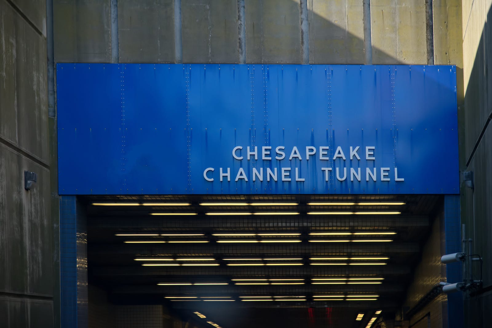
Instead, sections of tunnel were built elsewhere, floated into the bay, and lowered into trenches dredged beneath the shipping channels. Once positioned, the sections were joined and covered, creating a roadway beneath the channel while ships continued to move across the water above.
More than six decades later, the crossing is being expanded differently. The new parallel tunnel beneath Thimble Shoal Channel was excavated by a tunnel-boring machine working beneath the bay floor.
The methods have changed, but the purpose remains much the same: carrying the highway beneath a place that needs to remain open to ships.
From ferry route to highway
When the Chesapeake Bay Bridge–Tunnel opened on April 15, 1964, the automobile ferry service across the lower bay ended.
A crossing that had required an approximately 85-minute ferry trip became part of a continuous highway.
That changed the relationship between the Eastern Shore and Hampton Roads.
U.S. 13 no longer ended at the water. It continued directly across it, connecting the Delmarva Peninsula with Virginia Beach and the broader Hampton Roads region.
The crossing also created another north-south option along the East Coast.
Without it, a driver traveling between coastal Virginia and the Delmarva Peninsula must go around Chesapeake Bay. With it, U.S. 13 becomes a continuous corridor down the peninsula and across the mouth of the bay.
Seen this way, the Bridge–Tunnel does more than shorten a trip.
It closes a gap in the road network created by the geography itself.
A crossing built in stages
The route that exists today has changed considerably since 1964.
The original facility carried opposing traffic across a two-lane roadway. As traffic increased, parallel bridges, trestles, and roadways were constructed alongside much of the original crossing. They opened in 1999, creating four lanes across most of the route.
The tunnels remained different.
Because the original tunnels still carried opposing traffic through a single tube, they became the remaining narrow points in an otherwise expanded highway.
The next stage has been to begin duplicating them as well.
A parallel tunnel beneath Thimble Shoal Channel is now under construction. When completed, the new tunnel is intended to carry two southbound lanes while the original tunnel carries two northbound lanes.
The project is a modern continuation of the same problem engineers faced when planning the original crossing: highway capacity can be expanded, but it still has to work around the maritime channels that shaped the route in the first place.
The crossing can change.
The geography does not.
Traveler Experience
For much of the crossing, driving the Chesapeake Bay Bridge–Tunnel feels less like crossing a bridge than following a road laid across open water.
The roadway stays relatively low. Miles pass with water on either side, and the opposite shore can remain distant enough that the crossing feels temporarily detached from land.
Then the road begins to descend.
An artificial island grows larger ahead, the roadway drops toward it, and the broad horizon gives way to the enclosed walls of the tunnel. After miles spent above the bay, the change is abrupt: open water becomes concrete, daylight becomes artificial light, and the shipping channel passes unseen overhead.
The transition reverses at the other end. Daylight appears ahead and gradually brightens. The road climbs toward it, emerges onto another island, and returns to the open bay.
Then the crossing begins again.
That repeated movement—miles above the water, a descent beneath it, and a return to daylight—is what makes traveling the Chesapeake Bay Bridge–Tunnel different from simply driving across a long bridge. The route makes its changing relationship with the bay something a traveler can see and feel.
Why this connection matters
It is easy to describe the Chesapeake Bay Bridge–Tunnel through numbers.
Miles of roadway. Miles of trestle. Artificial islands. Underwater tunnels. Decades of construction and expansion.
Those measurements help explain the scale of the structure, but they do not quite explain the route.
The more revealing story is one of competing movements.
Vehicles need to cross the mouth of Chesapeake Bay.
Ships need to enter and leave it.
The Eastern Shore needs a connection toward Hampton Roads.
The Delmarva Peninsula needs a route toward coastal Virginia.
And the geography allows none of those movements to happen simply.
The Chesapeake Bay Bridge–Tunnel turns those requirements into a continuous road. It crosses open water, touches islands built for the crossing, disappears beneath shipping channels, rises again, and continues toward the opposite shore.
For the driver, the route provides continuity where the landscape appears to offer none.
The road does not overcome the geography so much as adapt itself to it.
Editor’s Perspective
Roads and shipping lanes usually appear as separate systems. At the mouth of Chesapeake Bay, they occupy the same geography.
The Bridge–Tunnel makes that relationship unusually visible. The highway rises, descends, and disappears because another route—one traveled by ships—has to remain open.
It is a reminder that connections rarely exist in isolation. Sometimes one route can only work because it has been designed around another.
Continue the Journey
Woven Routes looks at the bridges, ferries, tunnels, passes, and other crossings that connect places across geographic divides.
Continue Exploring
The San Juan Island Ferry Crossings →
In Washington’s Salish Sea, ferries provide the connection that the Chesapeake Bay Bridge–Tunnel makes permanent: carrying a road journey across a landscape divided by water.
Woven Routes Editorial
Part of the Renascent Works Travel Collection, exploring the routes, crossings, and connections that shape how we travel.