
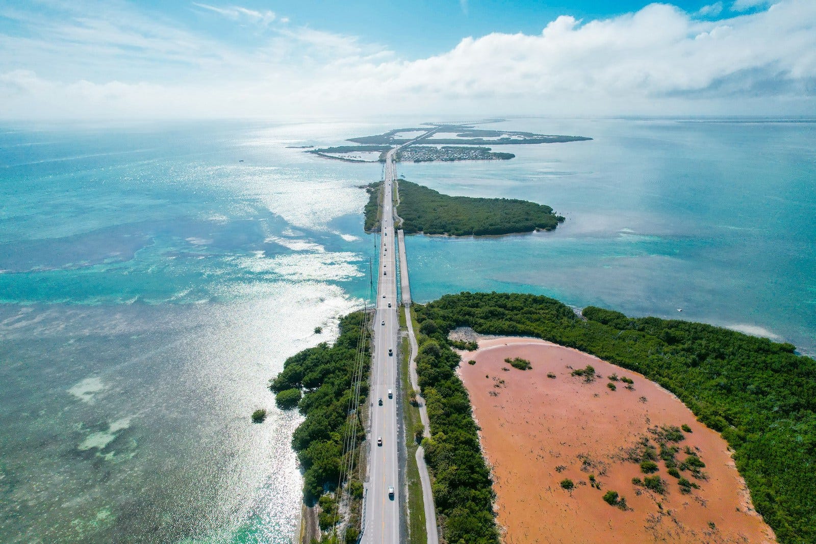
How a chain of islands became one of North America's most remarkable island corridors.
Some routes pass through landscapes.
Others become part of them.
The Overseas Highway stretches across more than one hundred miles of islands, bridges, and causeways between mainland Florida and Key West. Rather than following a coastline or climbing through mountains, it advances from island to island, with the surrounding ocean rarely disappearing from view.
Its path feels unlike most highways. Land appears, narrows, gives way to water, then returns again. The highway advances through a steady rhythm of islands and crossings, repeatedly moving from land to open water and back again.
The result is one of North America’s most distinctive island corridors—a route where geography and engineering remain inseparable.
Geography
The Overseas Highway follows the Florida Keys, an archipelago extending southwest from the southern tip of the Florida peninsula into the Straits of Florida.
Beginning near Florida City, the route reaches Key Largo before continuing through the Upper, Middle, and Lower Keys to its terminus in Key West.
Unlike barrier islands formed by shifting sand, the Keys are built upon ancient coral reef and limestone formations. Their narrow shape leaves little room for transportation infrastructure, requiring the highway to alternate repeatedly between stretches of land and bridges across open water.
Throughout much of the journey, the Atlantic Ocean lies to one side while the waters of Florida Bay and the Gulf of America—also widely known as the Gulf of Mexico—lie to the other. Few highways maintain such a continuous relationship with the surrounding sea.
Connection Diagram
Mainland Florida
↓
Florida City
↓
Key Largo
↓
Islamorada
↓
Marathon
↓
Seven Mile Bridge
↓
Big Pine Key
↓
Key West
Rather than serving a single destination, the Overseas Highway links an entire island chain, creating the only continuous roadway between mainland Florida and the inhabited Florida Keys.
Route Profile
Route Type
Island Corridor
Movement
Progresses steadily from island to island, alternating between causeways, bridges, and narrow stretches of land across the Florida Keys.
Landscape Relationship
Follows a naturally formed archipelago, remaining in continual conversation with the surrounding ocean rather than following a continental coastline.
Companion Connection
Henry Flagler’s Overseas Railroad, whose bridges first established a continuous transportation corridor through the Keys.
Travel Rhythm
Measured and expansive, with frequent transitions between land and water encouraging an awareness of gradual progression rather than speed.
Connections
Links mainland Florida with the communities of the Upper, Middle, and Lower Keys before reaching Key West.
Why It Endures
Few routes demonstrate so clearly how transportation infrastructure can connect an island chain while preserving its distinctive relationship with the surrounding sea.
History
For centuries, the Florida Keys remained connected primarily by water. Individual islands supported small communities, but traveling the length of the archipelago required boats capable of navigating the shallow channels between them.
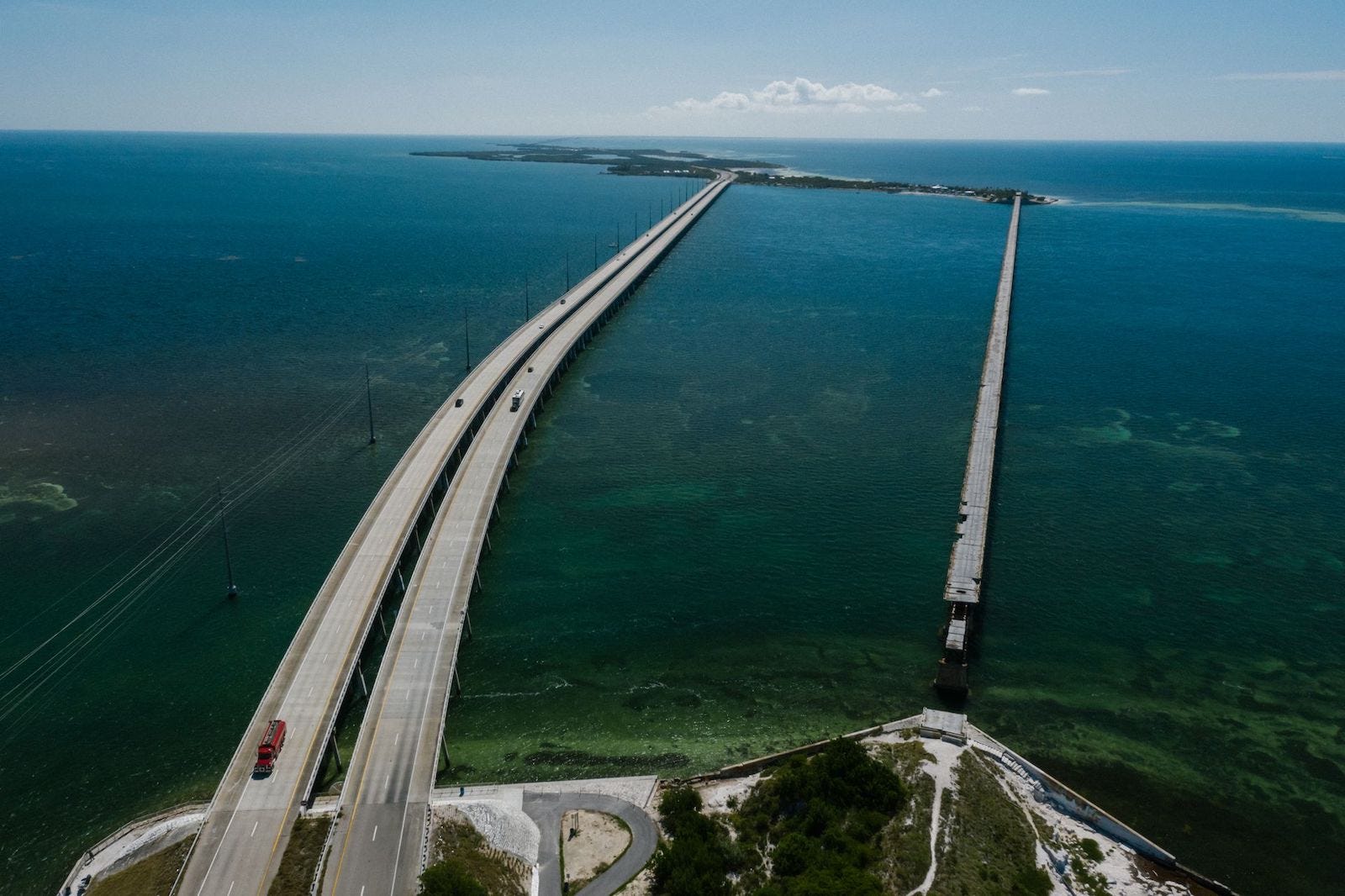
That changed in the early twentieth century with Henry Flagler’s Florida East Coast Railway Extension, often called the Overseas Railroad. Completed in 1912, the railway crossed dozens of bridges to reach Key West, representing one of the era’s most ambitious engineering achievements.
The Labor Day Hurricane of 1935 destroyed large sections of the railway. Rather than rebuilding the line, many of its bridge foundations and rights-of-way were adapted for a new highway. When the reconstructed Overseas Highway opened in 1938, it incorporated much of the railroad’s former path and bridges, transforming the earlier highway into a far more continuous road connection through the Keys.
Today’s highway has continued to evolve, with newer bridges replacing earlier structures while preserving the essential alignment that has connected the islands for nearly a century.
Network
The Overseas Highway functions as both a regional transportation corridor and one of America’s most recognizable scenic routes.
For residents of the Florida Keys, it is the primary connection to mainland Florida, supporting daily travel, commerce, emergency services, and tourism throughout the island chain.
For travelers, the highway offers something different. Rather than bypassing the landscape, it becomes the landscape’s organizing spine, revealing how individual islands relate to one another and how each crossing contributes to a larger whole.
Its most famous structure, the Seven Mile Bridge, has become an icon in its own right. Yet within the larger corridor it serves as only one chapter in a continuous sequence of crossings that defines the journey from beginning to end.
Traveler Experience
Traveling the Overseas Highway is marked by repetition in the best sense of the word.
Each bridge gives way to another island. Each island narrows before another crossing begins. The horizon rarely disappears, and the surrounding water provides a constant sense of orientation throughout the journey.
Communities appear gradually rather than abruptly, separated by open stretches that emphasize the distance between islands while reminding travelers that each remains part of a connected chain.
Unlike many scenic roads where the destination eventually dominates the experience, the Overseas Highway encourages attention to the transitions themselves. The crossings become the journey.
The Overseas Highway demonstrates that some of the world’s most memorable routes are defined not by what they pass through, but by what they connect.
Its bridges and causeways transform a scattered archipelago into a continuous corridor while preserving the feeling that each island remains distinct. The route succeeds because it allows travelers to experience both connection and separation at the same time.
Editor’s Perspective
The Overseas Highway reminds us that movement is sometimes shaped as much by geography’s limitations as by its possibilities. In the Florida Keys, there is no broad landscape to cross and few alternate paths to follow. Instead, the route becomes a thread binding together a chain of islands, revealing how transportation can unite places without diminishing the individuality of each one.
Continue the Journey
Every corridor tells a different story about movement across the landscape. From mountain passes to island chains, each reveals another way geography shapes how we travel and connect.
Continue Exploring
Columbia River Gorge Scenic Highway
From the tropical waters of the Florida Keys, the journey continues to the Pacific Northwest, where a historic roadway follows one of North America’s great river corridors between the Cascade Range and the Columbia Basin.
Woven Routes Editorial
Part of the Renascent Works Travel Collection, exploring the routes, crossings, and connections that shape how we travel.