
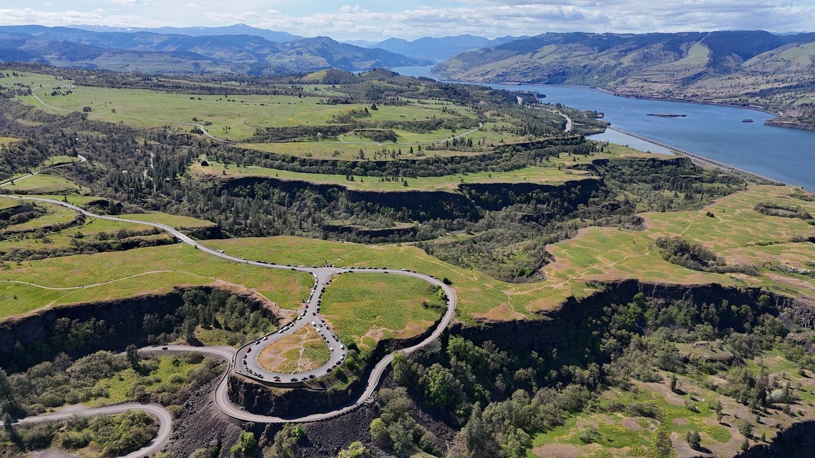
How an early scenic highway turned one of the Pacific Northwest’s great natural passages into a route of its own.
Long before there was a highway through the Columbia River Gorge, there was already a corridor.
The Columbia River cuts through the Cascade Range on its journey toward the Pacific, creating a rare low passage through mountains that otherwise form a substantial north-south barrier. For centuries, the river and its banks shaped movement through the region, first for Indigenous peoples and later for boats, railroads, roads, and interstate traffic.
The Historic Columbia River Highway added something different.
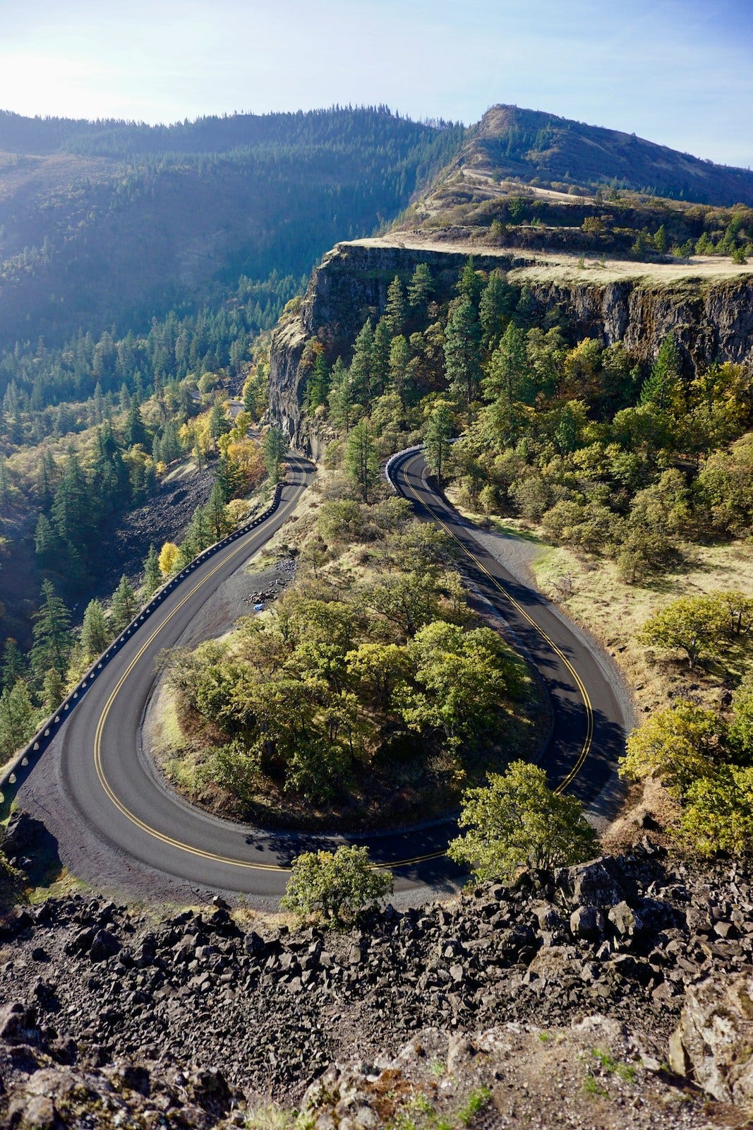
Rather than treating the gorge simply as an obstacle to pass through, its designers created a road intended to reveal it. Curves followed the terrain. Stone walls framed overlooks. Bridges crossed narrow ravines and waterfalls. The highway became both transportation infrastructure and an interpretation of the landscape it traversed.
More than a century later, that relationship remains its defining characteristic.
Geography
The Columbia River Gorge stretches for roughly 80 miles as the Columbia River passes through the Cascade Range between Oregon and Washington.
Its geography is unusual. Rather than climbing over the mountains, the river cuts directly through them, creating a natural east-west passage between the interior Columbia Basin and the lower Columbia Valley leading toward Portland and the Pacific.
The historic highway follows the Oregon side of this passage.
From the Portland area’s eastern edge, the route enters increasingly steep terrain near the western gorge, where high rainfall feeds dense forests and waterfalls descending from basalt cliffs. Farther east, the landscape gradually opens and dries as the corridor emerges from the Cascades toward The Dalles and the Columbia Plateau.
The road therefore does more than follow a river. It moves through one of the Pacific Northwest’s most pronounced environmental transitions.
Connection Diagram
Portland
↓
Troutdale
↓
Crown Point
↓
Waterfall Corridor
↓
Cascade Locks
↓
Hood River
↓
The Dalles
↓
Columbia Basin
The sequence illustrates the highway’s larger role: following the Columbia from the metropolitan edge through the Cascade Range and toward the interior Northwest.
Route Profile
Route Type
River Corridor
Movement
Follows the Columbia River eastward through the Cascade Range, tracing cliffs, ravines, forested slopes, and elevated viewpoints rather than taking the most direct path through the gorge.
Landscape Relationship
Moves with the river while repeatedly rising above it, using curves, bridges, and overlooks to reveal the gorge from changing elevations.
Companion Connection
Interstate 84, the modern transportation artery through the Oregon side of the Columbia River Gorge.
Travel Rhythm
Measured and episodic. Forested curves, waterfalls, stone bridges, and overlooks interrupt forward movement and make the corridor feel like a sequence of encounters with the gorge.
Connections
Links the Portland region with communities along the Columbia Gorge and the drier landscapes east of the Cascade Range.
Why It Endures
The highway remains significant not simply because it crosses the Cascades, but because its design helped establish the idea that a road could reveal a landscape while moving through it.
History
By the early twentieth century, the Columbia River Gorge was already an important transportation corridor.
River traffic had long moved through the gorge, and railroads followed its banks during the nineteenth century. Roads remained comparatively difficult. Steep slopes, waterfalls, and fractured basalt made overland travel through the gorge challenging.
The Columbia River Highway emerged from an effort to change that.
Construction began in 1913, shaped by engineer Samuel C. Lancaster and highway advocate Sam Hill. Their ambitions extended beyond creating a practical road. Inspired partly by European mountain highways, they envisioned a route that would make the gorge itself visible and accessible.
That philosophy shaped nearly every aspect of the highway.
Instead of simply cutting the shortest possible line through the terrain, engineers used graceful curves, masonry guardwalls, arched bridges, and carefully positioned viewpoints. The road passed close to waterfalls and climbed to Crown Point, where travelers could look across a broad sweep of the Columbia.
By 1922, the highway connected Portland and The Dalles.
For its era, it represented an unusually deliberate marriage of engineering and landscape design. It also reflected a changing understanding of automobile travel: roads could become experiences rather than merely connections between places.
Network
The highway’s role began changing almost as soon as automobile travel accelerated.
A road designed for early twentieth-century vehicles was poorly suited to the increasing speed, size, and volume of traffic that followed. Newer sections of highway gradually assumed the practical transportation role, culminating in the modern interstate corridor now carried by I-84.
That transition could easily have made the original highway obsolete.
Instead, it clarified what made the older route distinctive.
I-84 and the historic highway now demonstrate two different approaches to moving through the same geography. The interstate prioritizes efficient movement along the river. The historic road slows down, rises into the surrounding terrain, and repeatedly turns attention back toward the gorge itself.
Parts of the original roadway were abandoned or disconnected as modern highways replaced them. Later preservation efforts restored surviving sections, while portions of former roadway have been incorporated into the Historic Columbia River Highway State Trail.
The result is no longer a single uninterrupted automobile highway in the way it once was. It is a layered corridor: historic roadway, recreational trail, modern interstate, railroad, and river all occupying variations of the same natural passage through the Cascades.
Traveler Experience
The historic highway reveals the gorge gradually.
Near its western end, forest encloses much of the road. Curves follow the contours of the terrain, occasionally opening toward the Columbia before returning beneath a canopy of Douglas fir and maple.
Water repeatedly intersects the route.
Streams descend from the surrounding plateau and cross the highway’s path on their way toward the river. Waterfalls appear close to the roadway, including Multnomah Falls, where the relationship between cliff, water, bridge, and road becomes especially visible.
Elsewhere, the highway climbs.
At Crown Point, the perspective changes from traveling beside the Columbia to looking across the gorge itself. The river becomes the organizing feature of a much larger landscape, with mountains rising on either side and the corridor extending toward the horizon.
Farther east, the transition becomes increasingly apparent. Forests thin. Rainfall decreases. Open slopes begin replacing the dense vegetation of the western Cascades.
The highway does not simply carry travelers through these changes.
Its design makes them difficult to miss.
The Columbia River Gorge Scenic Highway demonstrates that following a natural corridor can mean more than choosing the easiest passage through it.
The river created the opening through the Cascades. Generations of transportation systems followed. But the historic highway added another layer by treating the landscape itself as something the route should help travelers understand.
Its curves, bridges, overlooks, and changing elevations transformed movement through the gorge into a way of seeing the gorge.
Editor’s Perspective
Transportation corridors often become less visible as they become more efficient. Modern roads flatten curves, shorten travel times, and direct attention toward arrival.
The Historic Columbia River Highway preserves another idea.
A route can connect places while also revealing the geography between them. In the Columbia River Gorge, the road’s enduring significance comes from that balance: it follows an ancient passage through the mountains while continually reminding travelers why the passage exists in the first place.
Continue the Journey
Some routes cross landscapes. Others follow pathways the landscape established long before roads existed.
The Columbia River Gorge is one of those places. River, railroad, highway, interstate, and trail have accumulated within the same narrow passage, each reflecting a different era of movement through the Pacific Northwest.
Continue Exploring
Highway 1 — Following the Edge of California
Follow another iconic western corridor where the relationship between roadway and landscape defines the journey, this time along the meeting point between the California coast and the Pacific.
Woven Routes Editorial
Part of the Renascent Works Travel Collection, exploring the routes, crossings, and connections that shape how we travel.