
Some roads exist simply to shorten the distance between two places.
California State Route 1 does something different.
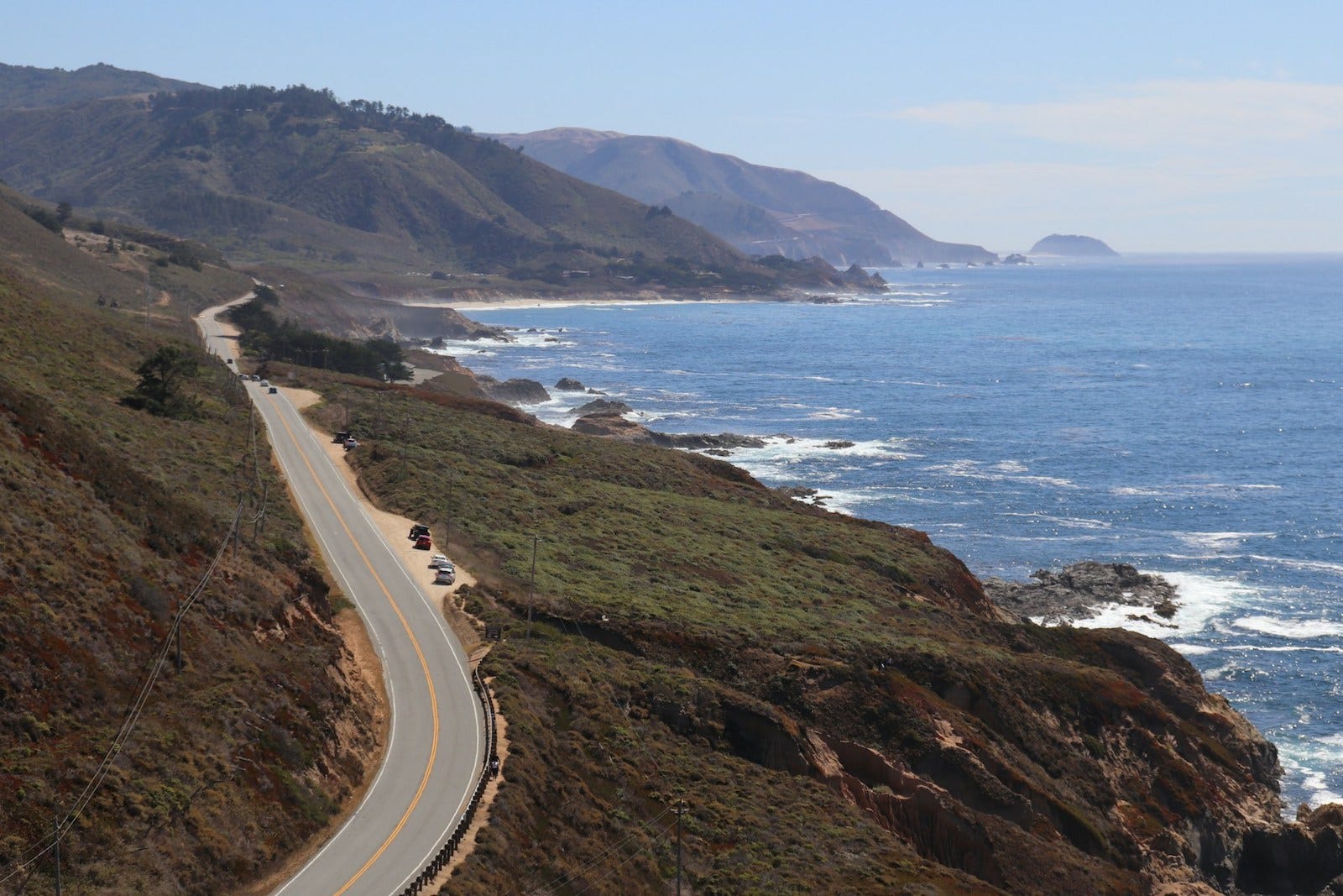
Rather than seeking the fastest path, it follows one of the continent’s most dynamic meeting places—the shifting boundary where mountains descend toward the Pacific Ocean. In doing so, the road becomes less of a connector between destinations and more of a companion to the landscape it follows.
Across much of California, travelers can move quickly along inland highways, reaching cities efficiently with little awareness of the coast. Highway 1 offers another rhythm entirely. Progress slows. Curves replace straight lines. Horizons continually change. The journey becomes an ongoing conversation with the shoreline rather than a race toward the next destination.
That relationship between road and landscape is what has made Highway 1 one of North America’s defining travel corridors.
The Road That Follows the Coast
Unlike many highways planned primarily around efficiency, Highway 1 often appears to negotiate with the land rather than overcome it.
Headlands force the road inland before allowing it to return to the ocean. River valleys briefly open broad views before cliffs narrow the route again. Marine terraces lift the roadway above the surf, while steep canyons demand careful crossings.
The coastline determines nearly every movement.
Rather than imposing a straight line across the landscape, the road accepts the coastline’s irregular shape. Its many bends are not engineering imperfections but reflections of the geography it follows.
Travelers quickly begin noticing this pattern. Ocean views arrive and disappear without warning. Dense forests suddenly replace open bluffs. Small agricultural valleys interrupt stretches of rugged shoreline before the coast reasserts itself once more.
Movement becomes varied, even over relatively short distances.
More Than a Scenic Highway
Highway 1 is often described as one of the world’s great scenic drives.
While the scenery is undeniable, that description captures only part of its significance.
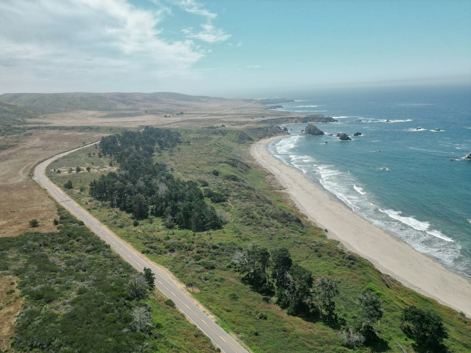
The road has become culturally recognizable because it encourages a different way of moving through a landscape. Its frequent curves, changing elevations, coastal weather, and numerous viewpoints naturally discourage hurried travel.
The route invites observation.
Even without stopping, travelers become more aware of changing light, shifting vegetation, ocean conditions, and the subtle transitions between communities. The road itself quietly regulates the pace at which the landscape is experienced.
Its identity comes not from individual landmarks but from the continuous sequence of change.
Highway 1 and Highway 101: Two Complementary Routes
One of the most interesting aspects of coastal California is that two major north–south highways often travel through the same broader region while serving very different purposes.
Highway 101 functions as the principal transportation corridor. It links cities, carries commercial traffic, and provides the faster route for most long-distance travel.
Highway 1, by contrast, remains much closer to the shoreline wherever geography allows.
The two roads occasionally converge before separating again, each responding differently to the same landscape. Where cliffs become too steep or mountains press directly against the sea, Highway 101 often assumes the practical role. Elsewhere, Highway 1 returns to trace the coastline more closely.
Rather than competing, the highways complement one another.
Together they reveal an important truth about California’s coast: there has never been a single way to move through it.
Traveling at the Speed of the Landscape
Perhaps the defining characteristic of Highway 1 is the pace it naturally establishes.
Travel time becomes measured less by miles than by changing landscapes.
Morning fog may reduce visibility before lifting to reveal distant headlands. Agricultural fields gradually give way to rocky shorelines. Temperatures shift as the road climbs away from the ocean before descending once again.
These transitions occur gradually enough to be noticed.
The experience resembles following the coastline’s own rhythm rather than imposing one upon it. The road slows travelers just enough to perceive relationships that higher-speed travel often obscures.
Rather than simply passing through California’s coast, the journey unfolds alongside it.
What the Road Connects
Highway 1 certainly connects towns, beaches, harbors, bridges, and state parks.
Yet its deeper connections are less obvious.
It links distinct ecological regions shaped by changing climate and topography. It follows coastlines where marine influence reaches inland before retreating again. It traces historic communities that developed around fishing, agriculture, ports, and coastal trade while remaining separated by dramatic stretches of undeveloped shoreline.
The road also connects different experiences of California itself.
Urban waterfronts gradually yield to agricultural valleys. Broad beaches transition into rocky cliffs. Working harbors become quiet coastal settlements before giving way once again to expansive stretches where the landscape dominates.
The corridor's continuity lies not in uniformity, but in the steady unfolding of change.
Viewed as a travel corridor, Highway 1 reveals several defining characteristics.
Route Profile
Route Type
Coastal Corridor
Region
California Coast
Primary Route
California State Route 1
Movement Pattern
The character of the journey shifts continuously as the road alternates between exposed coast, sheltered coves, agricultural valleys, forests, and small coastal communities.
Travel Rhythm
Measured, winding, and continually changing. The road encourages observation rather than speed.
Landscape Relationship
Rather than cutting across the terrain, the corridor follows the coastline’s natural contours, adapting to cliffs, river valleys, marine terraces, and headlands.
Companion Route
U.S. Highway 101 provides the faster inland alternative, while Highway 1 remains the route that most closely follows the Pacific shoreline.
What It Connects
More than towns, the corridor links diverse ecosystems, historic coastal settlements, and the changing relationship between land and sea.
Why It Matters
Highway 1 demonstrates how a transportation corridor can become a defining way of experiencing an entire landscape rather than simply moving through it.
Continue the Journey
Some roads become memorable not because of where they begin or end, but because of how faithfully they follow the landscapes between.
Its significance lies in more than dramatic views or celebrated stretches of coastline. The road offers a way of understanding California through movement itself—revealing how geology, climate, ecosystems, and communities unfold in sequence along the Pacific edge.
It is a reminder that the character of a route is often shaped not by the distance it covers, but by the relationships it reveals.
Further Reading
To explore the landscapes connected by Highway 1—from coastal headlands and marine terraces to the communities along its course—read A Thoughtful Guide to the Central California Coast from Hearthline, which examines the region through the places this corridor connects.
Woven Routes Editorial
Part of the Renascent Works Travel Collection, exploring the routes, crossings, and connections that shape how we travel.