
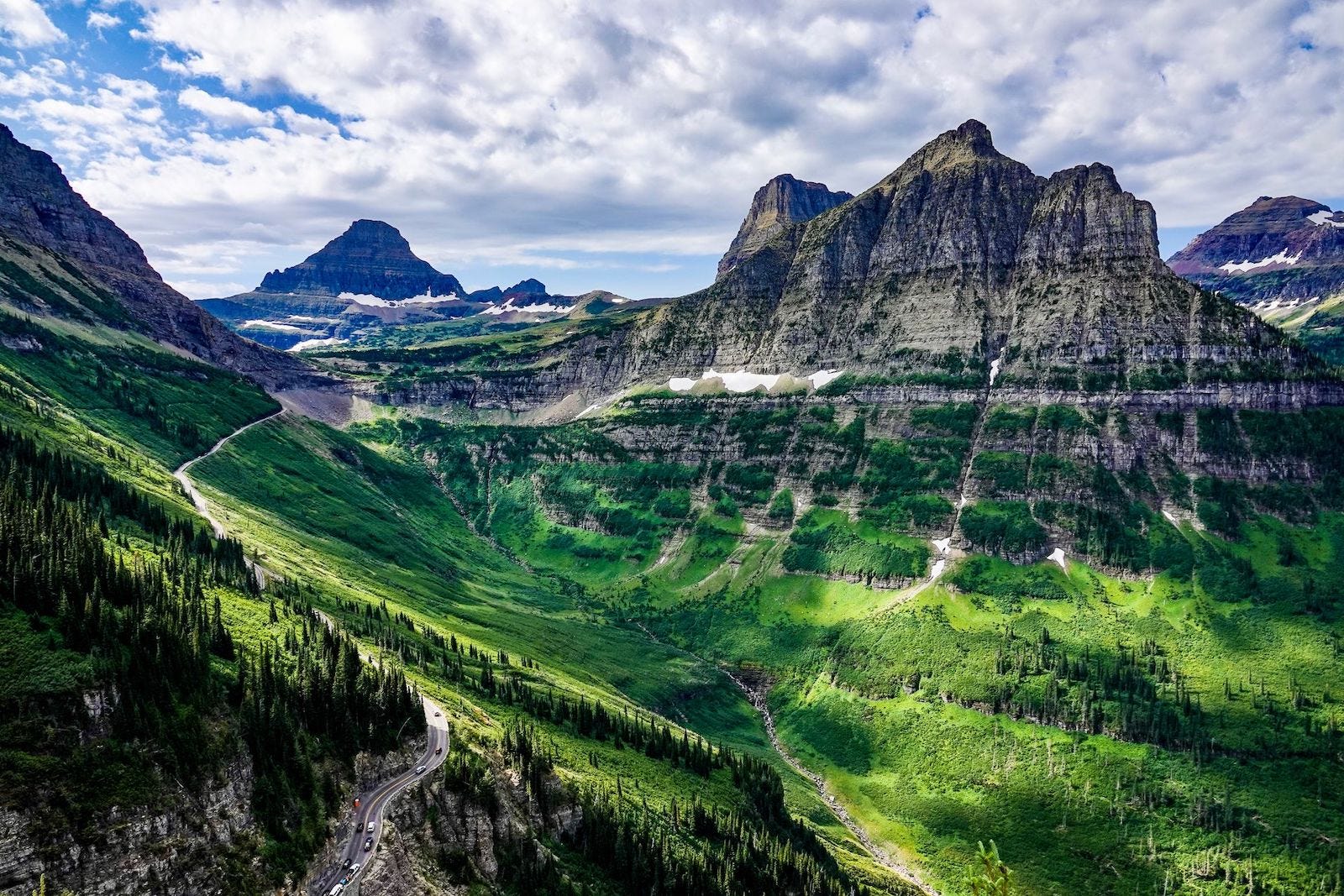
How one mountain highway became one of North America’s most remarkable landscape corridors.
Some routes exist because they are the quickest way between places.
Others exist because crossing the landscape itself is the purpose.
Going-to-the-Sun Road belongs firmly to the second category. Stretching across the heart of Glacier National Park in northwestern Montana, the road connects the park’s eastern and western valleys while climbing over the Continental Divide at Logan Pass. Along the way, it threads through forests, glacial valleys, alpine meadows, sheer cliffs, and some of the most dramatic mountain scenery in the United States.
Despite its fame, the road is more than a scenic drive. It is a carefully designed corridor that allows travelers to experience an entire mountain system in a single crossing.
Geography
The route runs approximately 50 miles (80 km) from West Glacier near the Middle Fork of the Flathead River to St. Mary on the park’s eastern edge.
Rather than remaining within a single valley, the road gradually ascends through multiple ecological zones before reaching Logan Pass at 6,646 feet (2,026 m). Beyond the pass, it descends into the drier eastern slopes of the Rocky Mountains.
The journey crosses the Continental Divide, where waters begin separate paths toward the Pacific Ocean and the Atlantic via the Gulf of Mexico.
Because the road follows existing terrain wherever possible, travelers experience continuous transitions rather than abrupt changes. Dense cedar forests give way to alpine tundra before yielding to broad glacial valleys and open grasslands on the eastern side.
Connection Diagram
Kalispell
↓
US 2
↓
West Glacier
↓
Lake McDonald
↓
The Loop
↓
Logan Pass
(Continental Divide)
↓
St. Mary Lake
↓
St. Mary
↓
US 89
Rather than functioning as an isolated scenic drive, Going-to-the-Sun Road forms Glacier National Park’s primary east-west crossing, linking two distinct mountain landscapes and connecting with larger regional highway networks at either end.
Route Profile
Route Type
Mountain Corridor
Movement
Climbs steadily from temperate forest to alpine tundra before descending into the open eastern slopes of the Rockies.
Landscape Relationship
Follows glacial valleys, ascends mountain slopes, and crosses the Continental Divide rather than bypassing it.
Companion Connection
U.S. Highway 2 provides the lower-elevation alternative around Glacier National Park.
Travel Rhythm
Slow, deliberate, and continually changing as elevation and landscape shift.
Connections
Links Glacier’s western and eastern valleys while connecting two major Rocky Mountain watersheds.
Why It Endures
It remains one of North America’s finest examples of a road designed to reveal a mountain landscape rather than simply traverse it.
History
For much of Glacier’s early history, crossing the park meant traveling by horseback or following rough trails between valleys.
During the early twentieth century, park leaders envisioned a road that would make Glacier’s interior accessible while preserving its rugged character. Construction began in the 1920s and continued through exceptionally difficult terrain, requiring engineers to carve narrow ledges into steep mountainsides while minimizing visual intrusion.
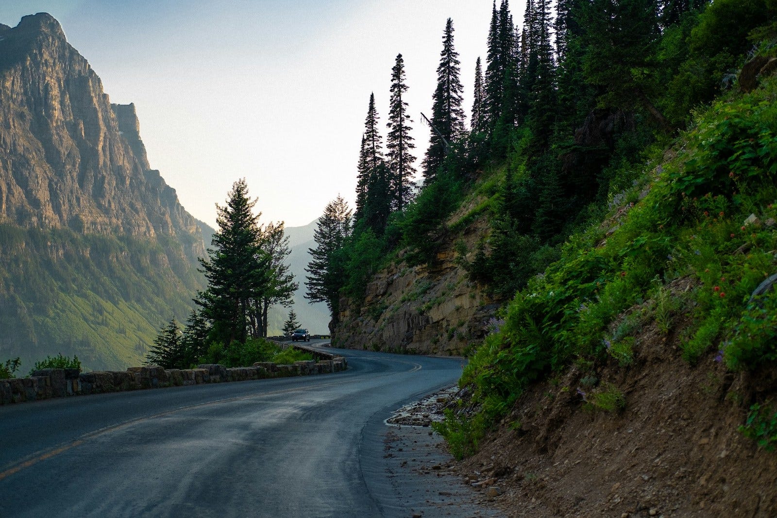
When completed in 1933, Going-to-the-Sun Road represented a new philosophy of park road design. Rather than imposing a highway upon the landscape, its alignment sought to follow natural contours, allowing the scenery to remain the dominant feature.
Today the road is recognized as a National Historic Civil Engineering Landmark and a National Historic Landmark, reflecting both its engineering achievement and its influence on later park road design.
Network
Unlike interstate highways built primarily for efficient transportation, Going-to-the-Sun Road serves multiple roles simultaneously.
It is Glacier National Park’s principal east-west corridor.
It connects visitor facilities, trailheads, campgrounds, and mountain passes.
It links the wetter forests west of the Continental Divide with the dramatically different eastern slopes.
Because of heavy snowfall, however, the route is seasonal. Annual snow removal can require months of work before the entire road reopens, making its availability part of Glacier’s natural rhythm rather than a year-round transportation corridor.
Its relationship with surrounding highways is equally important. U.S. Highway 2 provides a lower-elevation route around the park, while Going-to-the-Sun Road offers a direct crossing through its mountainous interior. Together they illustrate two very different ways of moving across the northern Rockies.
Traveler Experience
Traveling Going-to-the-Sun Road is less about reaching the opposite side of Glacier than about gradually understanding the mountain system itself.
The road unfolds in stages. Long lakes introduce the western valleys before the climb begins in earnest. Tight curves and narrow ledges reveal increasingly expansive views as elevation increases. Near Logan Pass, trees give way to alpine meadows shaped by snow and wind.
Crossing the Continental Divide is not marked by a dramatic summit alone, but by subtle changes in climate, vegetation, and geology that continue throughout the descent.
The experience rewards attentive movement. Every few miles the surrounding landscape changes, revealing another chapter in the story of glaciers, mountains, and water that shaped the park.
Few roads compress so much geographic change into such a short distance.
Going-to-the-Sun Road is more than a mountain highway. It is a carefully composed passage through Glacier National Park, revealing how valleys, watersheds, and alpine landscapes connect across the Continental Divide.
The road succeeds not because it overcomes the mountains, but because it follows them.
Editor’s Perspective
Going-to-the-Sun Road reminds us that the most memorable routes are not always the fastest or the oldest. Some are significant because they reveal how landscapes are connected. In Glacier National Park, movement itself becomes a way of understanding geography, with each mile offering another perspective on the mountain system rather than simply another viewpoint.
Continue the Journey
Every route connects to something beyond itself.
Going-to-the-Sun Road is one of North America’s defining mountain corridors, but it is only one way of understanding Glacier National Park. The surrounding valleys, watersheds, and communities reveal a broader landscape, while other great routes demonstrate different ways geography shapes movement.
Further Reading
A Thoughtful Guide to Glacier National Park (coming soon from Hearthline)
Explore Glacier National Park as a connected mountain region, with guidance on its valleys, trail systems, lakes, and the landscapes that surround Going-to-the-Sun Road.
Continue Exploring
Columbia River Gorge Scenic Highway
From the Rocky Mountains to the Pacific Northwest, the Columbia River Gorge Scenic Highway follows another remarkable landscape corridor—this time tracing one of North America’s great river passages between the Cascade Range and the Columbia Basin.
Woven Routes Editorial
Part of the Renascent Works Travel Collection, exploring the routes, crossings, and connections that shape how we travel.